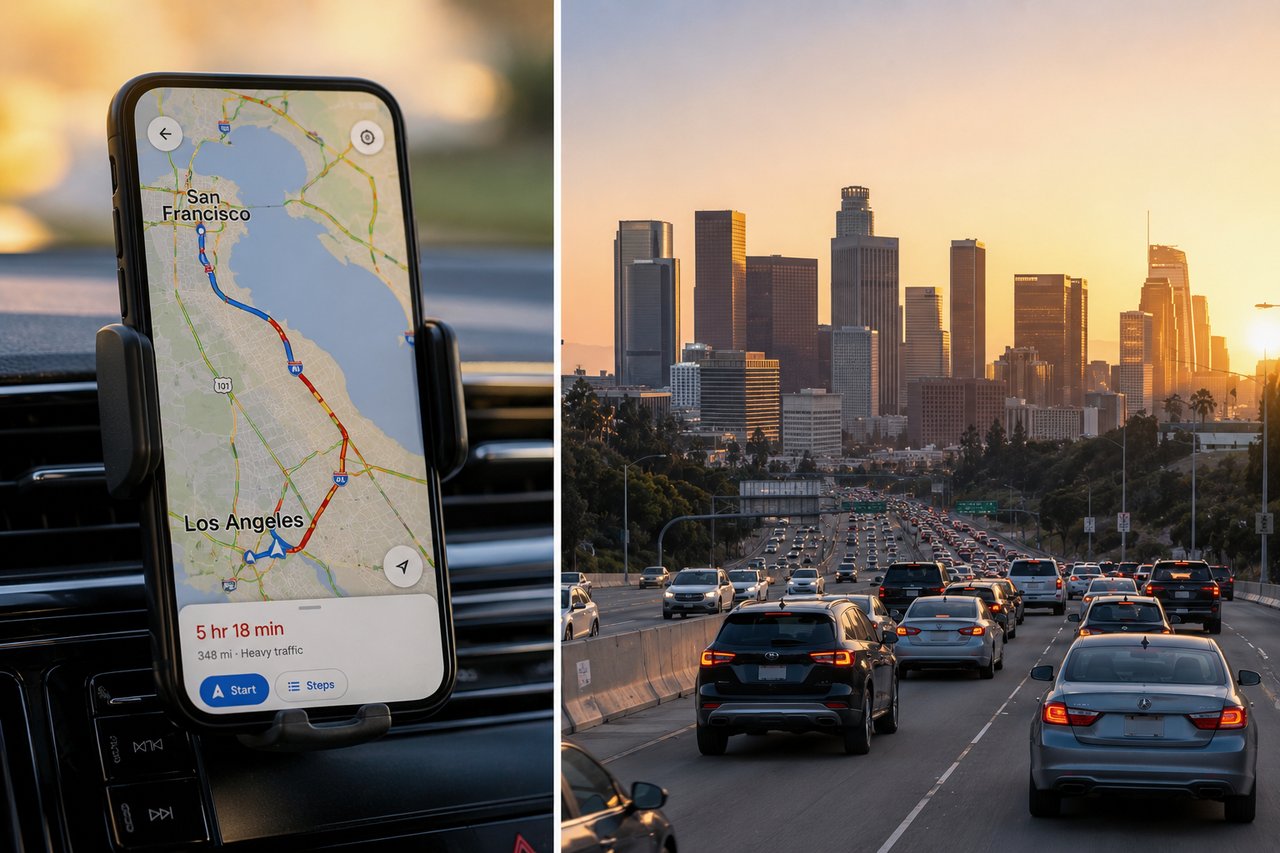
Google Maps is the default commute tool for millions of Americans and for good reason. The average one-way commute clocks in at 26.9 minutes, with 76.4% of commuters driving alone to work. That is a lot of time spent trusting an app's estimate. What the app calculates, however, is drive time only. Gas stops, meal breaks, and unexpected detours are left out of the equation entirely. Regional driving habits add another layer of complexity. California drivers, for instance, routinely exceed posted speed limits, which means the gap between what Google Maps predicts and what the road actually delivers can be significant. Moving between San Francisco and Los Angeles offered a real-world opportunity to put those estimates to the test.
Testing Google Maps Commute Time Accuracy: My First Month in LA
The first month of daily drives around Los Angeles told a clear story. For short-to-medium trips under normal conditions, Google Maps held up well. Studies back this up estimates typically fall within 1-2 minutes of actual travel time, and the system maintains accuracy for over 97% of trips.
Timing the check, however, made a meaningful difference. Pulling up the route right before leaving yielded estimates that landed within 5-15 minutes for trips covering 30-40 miles. Checking hours ahead was a different experience entirely. The app would display ranges like "typically 1h - 1h 50m" a 50-minute window that is more uncertainty than guidance.
Rush hour was where estimates broke down most visibly. Peak commute windows mornings from 7-10 AM and afternoons from 4-7 PM routinely pushed travel times up to 60 percent beyond the original estimate, especially on the 405. What the app showed at the moment of departure could shift quickly. A 35-minute estimate had a way of becoming 50-plus minutes before the first few miles were behind you.
Where the system genuinely earned its reputation was on the road. Accidents and sudden slowdowns triggered rerouting in real time, though delays from unexpected incidents were occasionally underestimated. It responds well to what is already happening predicting what might happen is a separate matter.
What Affects Google Maps Travel Time Accuracy
"This research provides insight into the degree of confidence that planners and policy makers can expect from traffic forecasts and suggests that we should view forecasts as a range of possible outcomes rather than a single expected outcome." — Gregory D. Erhardt, Assistant Professor of Civil Engineering at the University of Kentucky
The accuracy Google Maps delivers traces back to the quality of data feeding it. At the core is real-time GPS data pulled from millions of Android devices and smartphones running location services. Phones with Google Maps open continuously transmit anonymous speed and location data. When a cluster of devices slows on the same stretch of road, the system recognizes congestion and recalibrates estimates accordingly.
Historical traffic patterns add a second, equally important layer. Years of aggregated data allow Google to identify recurring bottlenecks with surprising precision. The 280 freeway in Northern California, for example, typically sees vehicles moving at 65mph between 6-7am that same stretch drops to 15-20mph by late afternoon. Machine learning algorithms then marry this historical baseline to live conditions, projecting traffic forward by 10, 20, or even 50 minutes.
Human reporting fills gaps that sensors cannot. Google's 2013 acquisition of Waze folded driver-submitted reports accidents, road closures, hazards directly into routing logic. Local government data rounds out the picture, supplying information on planned roadwork, lane closures, and speed limit changes.
Weather is the notable blind spot. Rain and storms do not trigger direct adjustments within the system, though the resulting slowdowns eventually show up through declining real-time speed readings. The app catches the effect, not the cause.
How Google Maps Commute Differs Between San Francisco and Los Angeles
"We meter every other government-owned utility, but not our roads. It’s the only system that we don’t charge prices for, and it’s not a coincidence that it’s the only system that colossally breaks down about two times a day." — Michael Manville, Professor and Chair of Urban Planning at UCLA Luskin School of Public Affairs
Transit infrastructure tells the real story of how Google Maps performs differently across the two cities.
San Francisco ranks among the most transit-congested cities in the country. For commuters there, timing is everything. Seats are available at 9 a.m.; by 7–8 a.m., cars are standing room only. The same pattern plays out in the evenings 3 p.m. trains run comfortably, while those between 4–5 p.m. fill fast. Google Maps captures these windows reasonably well, but the city's compact geography introduces a separate problem. The app frequently suggests multi-leg connections between buses and streetcars when a 5–10 minute walk would eliminate the transfer entirely. It prioritizes the nearest stop, not necessarily the most useful one walking two blocks might mean more frequent service and a faster overall trip. Users have flagged genuinely puzzling transit routes from the app despite finding it reliable in other respects.
Los Angeles operates on an entirely different logic. The city's sprawling, decentralized layout and non-traditional employment hours mean commute patterns never fully settle into predictable rhythms. Traffic accuracy on Google Maps holds up better when checked at the exact moment of departure rather than hours before a habit that matters far more here than in SF. Even when an estimate starts accurately, sheer vehicle volume introduces variance that compounds quickly. Multimodal planning tools, including cycling integrations, made their debut in San Francisco and San Jose, but remain limited across the LA metro.
Both cities test the app's capabilities just in entirely different ways.
Conclusion
Google Maps earns its place as a reliable commute tool with one important caveat. Estimates checked at the moment of departure are far more trustworthy than those pulled hours in advance. Rush hour remains the great unknown, capable of stretching even confident predictions well beyond their mark. The app adjusts well to real-time conditions, but no algorithm accounts for every incident before it happens. Knowing these limitations is what separates a frustrating commute from a well-planned one. Check the route when ready to leave, build in a buffer for anything important, and treat Google Maps for what it is a real-time guide, not a crystal ball.
Key Takeaways
Understanding Google Maps' accuracy can transform your daily commute planning. Here's what real-world testing across two major California cities revealed:
• Google Maps achieves 97%+ accuracy for most trips, with estimates typically within 1-2 minutes for normal conditions, but checking right before departure yields far better results than advance planning.
• Rush hour dramatically impacts reliability—peak commute times (7-10 AM and 4-7 PM) can extend travel times by up to 60% beyond initial estimates, especially on major highways.
• Real-time data beats predictions—Google Maps excels at adjusting for current conditions using crowdsourced GPS data from millions of devices, but struggles to forecast unexpected incidents hours in advance.
• City infrastructure shapes accuracy differently—San Francisco's dense transit network creates complex routing challenges, while LA's highway-dependent sprawl makes traffic patterns less predictable despite similar technology.
• Build buffer time for critical appointments—even with 97% accuracy, the 3% variance combined with rush hour unpredictability means adding 15-20 minutes to important commutes prevents late arrivals.
The bottom line: Google Maps works best as a real-time navigation tool rather than a long-range planning device. Check estimates at departure, expect delays during peak hours, and always account for the unexpected.
FAQs
Q1. How reliable is Google Maps for predicting commute times in real-time? Google Maps achieves over 97% accuracy for most trips when checked at the time of departure, with estimates typically within 1-2 minutes under normal conditions. However, accuracy decreases significantly when checking hours in advance, as the system cannot predict unexpected incidents like accidents or sudden traffic changes that may occur before your trip begins.
Q2. Why does Google Maps sometimes underestimate travel time during rush hour? Rush hour traffic can extend travel times by up to 60% beyond initial estimates, especially during peak periods (7-10 AM and 4-7 PM). This happens because traffic conditions can worsen rapidly after you check the route, and the sheer volume of vehicles creates unpredictable delays that even real-time data struggles to capture fully.
Q3. What factors does Google Maps use to calculate travel time estimates? Google Maps combines real-time GPS data from millions of smartphones, historical traffic patterns from years of aggregated data, user-reported incidents through Waze, and authoritative information from local governments about roadwork and closures. Machine learning algorithms analyze these inputs to forecast traffic conditions and adjust estimates accordingly.
Q4. Should I add extra time to Google Maps estimates for important appointments? Yes, it's recommended to add 15-30 minutes of buffer time for critical appointments, even though Google Maps is generally accurate. Unexpected incidents, construction, weather-related slowdowns, and rush hour variability can all cause delays that weren't predicted when you first checked the route.
Q5. Does Google Maps account for parking time and rest stops? No, Google Maps only calculates drive time from point A to point B and does not include time for gas stops, meal breaks, parking searches, or other stops along the way. You'll need to manually add extra time for these activities when planning your total trip duration.