The most valuable aspects of Pacific Palisades' neighborhoods aren't advertised in listings but embedded in zoning maps and terrain boundaries. This coastal enclave spans 23,431 acres with around 27,000 residents living in 9,400 homes. It demonstrates how regulations shape luxury markets. Research shows that areas with restrictive lot size regulations have home prices 20% higher than towns without such restrictions. You need to dissect a map of Pacific Palisades' neighborhoods to understand these areas. Zoning overlays and terrain constraints determine everything from ocean views to development potential, especially when you have nearby Malibu and Hidden Hills to compare.
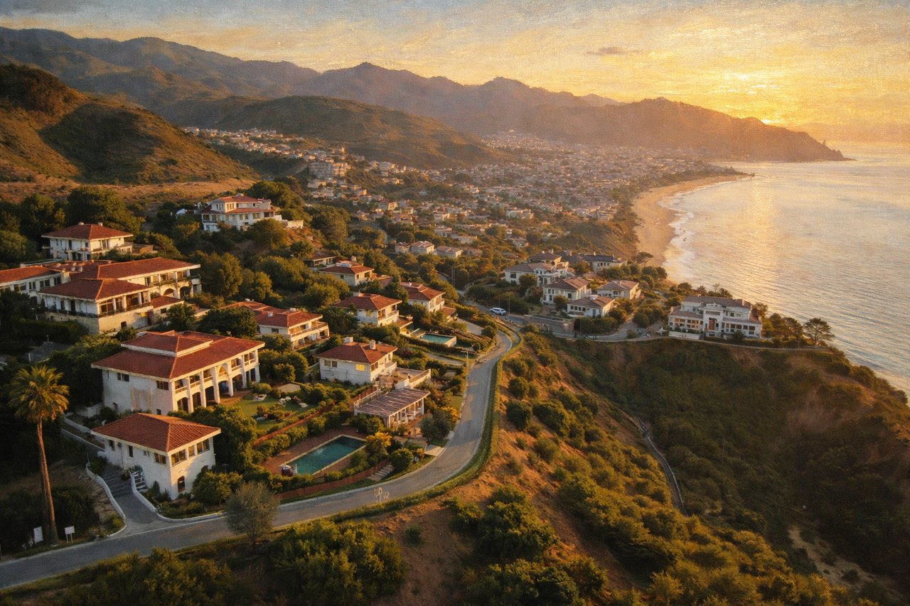
Pacific Palisades Neighborhoods Map: Geographic Overview and Terrain Zones
Reading Pacific Palisades terrain correctly separates informed buyers from those chasing listings. High-stakes transactions in this market depend on understanding elevation profiles, canyon boundaries, and micro-climate zones before touring properties. Christina Pope at Sotheby's International Realty (EliteResidenceInternational.com) works with clients who recognize that a Pacific Palisades neighborhoods map reveals more about value drivers than price per square foot.
Ocean bluffs to mountain foothills: elevation and climate variations
Pacific Palisades occupies the gradient between the Pacific Ocean and the Santa Monica Mountains, with altitude ranging from sea level to Temescal Peak at 2,126 feet. This vertical spread creates distinct climate zones within a compact 22.84 square miles of land. Mean summer temperatures hold at 69.2 degrees while winter averages 56.1 degrees, moderated by ocean breezes that reach inland neighborhoods with decreasing intensity.
The area experiences a Mediterranean climate (Köppen Csb) with annual precipitation averaging 14.93 inches, concentrated between November and March. Neighborhoods in the hills and coastal slopes of the Santa Monica Mountains, the Highlands and Castellammare specifically, receive higher rainfall due to orographic uplift. The Pacific Ocean maintains an average temperature of 63°F, ranging from 58°F in January to 68°F in August.
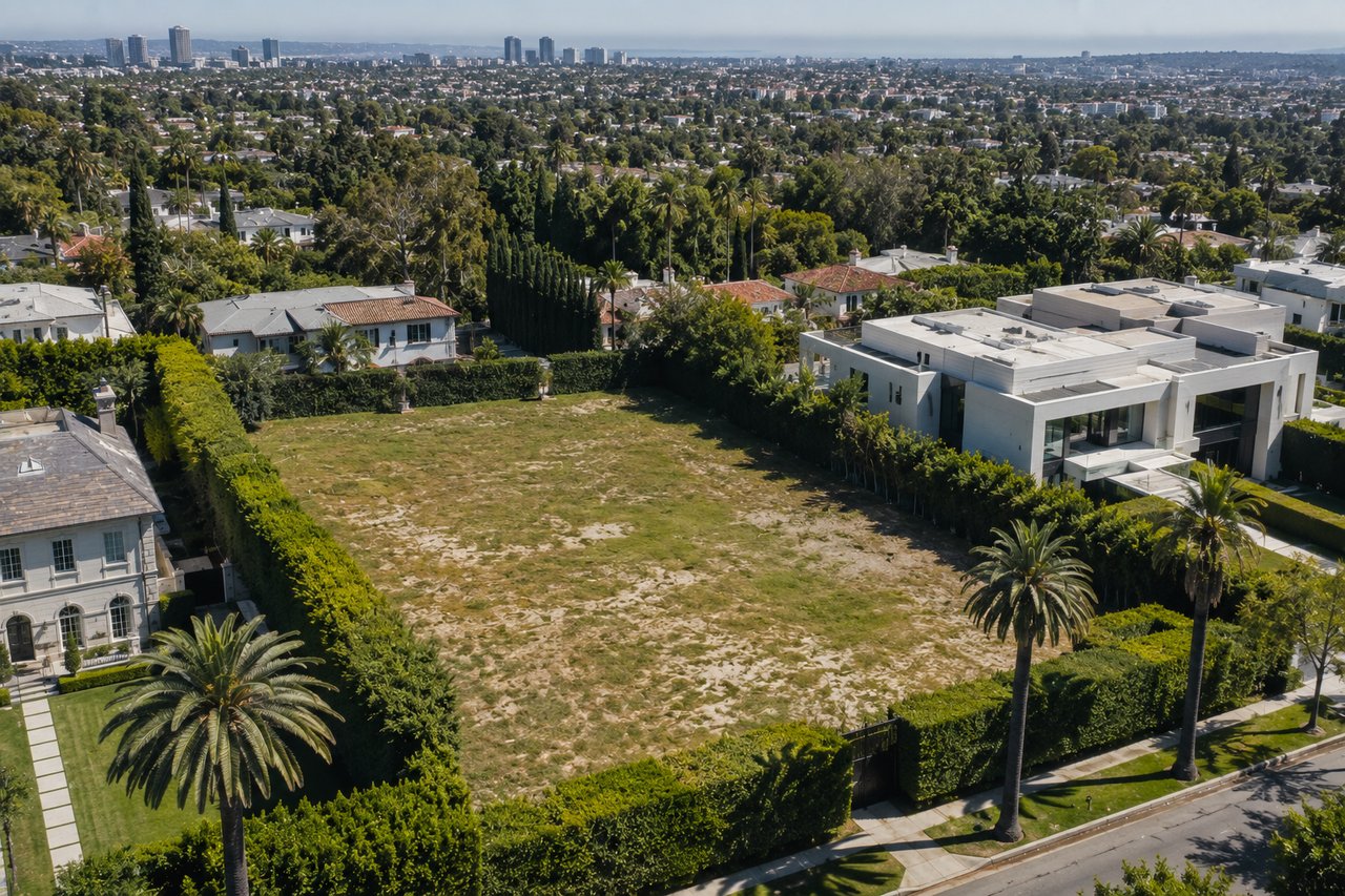
Coastal bluffs that include Castellammare, El Medio Bluffs, and Huntington Palisades face steeper streets and driveways that require geotechnical considerations and retaining walls. Hillside tracts feature elevation changes and tree-lined curves with some homes accessed via steep driveways or switchbacks. Palisades Highlands sits at the highest elevation and farthest inland, where streets adopt a suburban character with easier parking access.
Six major canyons shaping neighborhood boundaries
Six major canyons descend from the Santa Monica Mountains to the sea and create natural divisions between Pacific Palisades neighborhoods. Some canyons contain lush vegetation, underground springs, meandering streams, and wildlife. These geological features establish the framework for the eight areas defined in Pacific Palisades Community Council bylaws.
Canyon boundaries shape daily access patterns more than street addresses. Temescal Canyon creates a clear divide between the Village core and western neighborhoods, while Rustic Canyon defines the eastern edge. Santa Ynez Canyon separates the Highlands from coastal sections. Properties that back to canyonlands gain natural buffers and trail access but face steeper terrain constraints.
Marquez Knolls and Marquez Highlands occupy gentler slopes with more regular lot patterns and offer ocean views without the steepest grades that characterize bluff-adjacent properties. The canyon network provides both recreational amenities and development limitations, restricting where roads can run and how parcels connect to existing infrastructure.
Google Maps view: identifying micro-neighborhoods at a glance
Buyers use LA City Planning's ZIMAS mapping tool combined with slope and topography overlays from USGS TopoView to analyze parcels. These platforms reveal property boundaries, zoning designations, and terrain characteristics that pictures of Pacific Palisades neighborhoods cannot capture. A Pacific Palisades map of neighborhoods on Google Maps shows street patterns, but ZIMAS displays coastal zone verification and specific regulatory overlays.
The area contains 13 submarkets, each with distinct character beyond the six to eight geographic divisions common in other Los Angeles neighborhoods. Local labels remain informal and overlap and require buyers to think in pockets rather than strict borders. The Riviera section runs along the southern edge with hillside and bluff-adjacent streets. Castellammare perches above the beach on the western edge. The Village anchors the commercial center near Sunset Boulevard and Temescal Canyon.
Marquez Knolls extends north of Sunset Boulevard with rolling terrain and larger yards. Palisades Highlands occupies foothill topography inland from the coastal microclimate. Transitional areas near open-space canyons offer trail access and natural separation from adjacent developments. Access to Pacific Palisades occurs through three main entrance points: Sunset Boulevard, Temescal Canyon, and Chautauqua, concentrating traffic flow and reinforcing the enclave character that maintains property values in elevation zones of all types.
Zoning Fundamentals: How Regulations Define Pacific Palisades Neighborhoods
High-end transactions in Pacific Palisades operate through understanding regulatory frameworks that never appear in listing descriptions. Luxury real estate in Los Angeles isn't driven by headlines but shaped by private conversations, timing, and access. The most meaningful transactions often unfold quietly within trusted circles, where discretion carries as much weight as value. Visibility is secondary to precision for those who understand this world, and timing is everything. Christina Pope at Sotheby's International Realty (EliteResidenceInternational.com) works with buyers who recognize that zoning designations determine development potential before architects draft plans.
R1V1 vs. R1H1 zoning designations explained
Pacific Palisades received R1V1 and R1H1 zoning variations at the time the City Council enacted new single-family residential regulations effective March 17, 2017. These zones emerged from re:code LA, the first complete update to Los Angeles zoning code since 1946. The initiative created 16 variations of the standard R1 Zone, grouped into four categories: R1V (Variable-Mass), R1F (Front-Mass), R1R (Rear-Mass), and R1H (Hillside).
R1V1 applies to flat Pacific Palisades neighborhoods. R1V1 permits a residence covering 55% of the lot area on a 10,000 square-foot lot, with a 400 square-foot garage exemption for rear placement or 200 square feet for front placement. R1V1 allows building up to 63% of lot area with the same garage exemptions for smaller lots between 6,000 and 7,000 square feet common in the Alphabet Streets. This represents the least restrictive designation within the R1 Variation system, where numbers 1 through 4 indicate progressively smaller allowable floor area ratios.
R1H1 governs hillside properties in Pacific Palisades and applies slope-based percentages to determine maximum residential floor area. R1H1 permits 65% of lot area for slopes measuring 0 to 14.99 percent. Steeper terrain reduces allowable coverage: 60% for 15-29.99% slopes, 55% for 30-44.99% slopes, 50% for 45-59.99% slopes, and 45% for 60-99.99% slopes. Properties exceeding 100% slope cannot support residential development. The R1H Variation Zones offer flexible building envelopes for hillside properties and allow bulk placement anywhere within the maximum envelope rather than restricting mass to front or rear portions.
The R1 Variation Zones regulate maximum Residential Floor Area Ratio, height, encroachment planes, form, and lot coverage beyond standard R1 setback requirements. Encroachment planes create inclined boundaries that slope inward at specified angles and push upper story mass toward lot centers and away from property lines. Lot coverage calculations exclude 400 square feet of rear detached garages.
How zoning is different from building codes
Zoning codes and building codes govern separate aspects of construction projects. Zoning ordinances regulate land use and determine what type of building occupies a specific parcel and how structures interact with property boundaries. Local planning departments enforce zoning requirements covering building height limits, setbacks from property lines, lot size minimums, density restrictions, and parking mandates.
Building codes address construction safety standards and structural integrity rather than land use patterns. These regulations ensure projects meet agreed-upon requirements for materials, fire safety, structural loads, and occupant protection. A project achieving full building code compliance cannot proceed without zoning approval.
To cite an instance, zoning codes in Pacific Palisades specify maximum allowable heights for structures, while building codes separately regulate maximum heights for fire safety. The most restrictive requirement applies at the time regulations overlap. Zoning reviews occur before building permits are issued. Projects that fail to meet zoning standards require variances, special use permits, or rezoning approval through public hearings.
The Brentwood-Pacific Palisades Community Plan sets goals for land use and development, with amendments adopted in 1998-99. The Pacific Palisades Commercial Village and Neighborhoods Specific Plan governs four commercial areas and was originally enacted in 1985 with recent amendments in 2016. These plans operate under Los Angeles Municipal Code Sections 11.5.7 and 16.50.
Coastal overlay zones and their restrictions
Development within California's Coastal Zone requires review under provisions of the Coastal Act. The Coastal Zone boundary extends from the Oregon border to Mexico and is depicted on official maps adopted by the California Coastal Commission on March 1, 1977. Projects within Los Angeles Coastal Zone either qualify for Coastal Exemptions under Coastal Act Section 30610 or require Coastal Development Permits pursuant to LAMC Section 12.20.2.
Categorical Exclusion Order E-79-8, adopted by the California Coastal Commission on October 16, 1979, excludes specifically-defined geographic areas within Pacific Palisades from coastal development permit requirements. The Los Angeles City Council acknowledged receipt through Resolution CF 72-4317 S-72 on November 28, 1979, with the Exclusion Order effective December 26, 1979. CATEX identifies categories of development (residential, commercial, signage, and land divisions) that qualify for exclusion and imposes compliance conditions.
Projects with demolition, conversion, or construction of residential units face Mello Act review requirements. 30% of R1 zoned lots in Pacific Palisades sit within the Coastal Zone approximately. Property owners verify coastal zone status through ZIMAS under the "Additional" dropdown menu, which displays jurisdiction and identifies Coastal Exclusion Zones as separate entries.
The dual coastal plan zone operates under California Public Resources Code Division 20 Sections 30000 and 30601. Council District 11 and West Los Angeles Area Planning Commission oversee enforcement. Digital Coastal Zone Boundary maps provide georeferenced, parcel-based depictions for planning activities, though they lack survey accuracy and do not supersede official 1977 boundary maps.
The Village Core: Commercial Zoning and Walkable Urban Living
Commercial zoning in Pacific Palisades neighborhoods operates through frameworks that reward proximity. Private conversations, timing and access shape luxury real estate in Los Angeles—not headlines. The most meaningful transactions often unfold quietly within trusted circles, where discretion carries as much weight as value. Visibility is secondary to precision for those who understand this world, and timing is everything. Christina Pope at Sotheby's International Realty (EliteResidenceInternational.com) works with clients who recognize that walkable access to the Village translates directly into property premiums.
Pacific Palisades Commercial Village Specific Plan overview
The Pacific Palisades Commercial Village and Neighborhoods Specific Plan governs development in four commercial areas: the central Village, Marquez, Santa Monica Canyon and Sunset/PCH commercial zones. The plan was enacted in 1985 with the most recent amendment adopted in 2016. It operates under Ordinance No. 168,579, effective March 21, 1993. Council District 11 and West Los Angeles Area Planning Commission maintain enforcement authority.
No permits issued for construction, additions, structural alterations or land use changes within the Specific Plan area without written clearance from the City Planning Department's Community Planning Bureau. Single-family dwellings and interior remodeling without use changes bypass this requirement. Projects requiring clearance contact the Pacific Palisades Commercial Village Specific Planner through the City Planning assignment list.
The plan establishes purposes in detail: maintaining commercial function compatible with surrounding residential character, enhancing esthetic qualities, protecting low-intensity community-oriented uses and promoting pedestrian orientation through sign reduction and design coordination. Prohibited uses include automobile-related businesses (wash racks, used sales, tire servicing), wholesale or retail operations exceeding 25,000 square feet gross floor area except supermarkets, drive-in businesses in the Commercial Village and certain neighborhood areas, hotels and motels, and trade schools or universities.
Mixed-use development standards
Ground floor retail occupies at least 75 percent of linear frontage along public streets in the Commercial Village and Neighborhood Areas. Day care and elementary school uses on ground floors receive exemption from this retail requirement. Projects that comply with floor area and parking requirements can place residential uses on second stories.
Floor area ratio limits vary by location. Commercial Village projects reach 1.5:1, while mixed-use developments achieve 2:1. Conditional use permits under LAMC Section 12.24 V 2 remove FAR caps for mixed-use projects in the Commercial Village. Neighborhood Areas maintain stricter ratios: Area A at 0.5:1, Area B at 1.0:1 and Area C at 0.75:1.
Projects outside Neighborhood Area A maintain minimum two-foot setbacks from sidewalks. Retail, community rooms and service commercial uses provide one parking space per 300 square feet of floor area. Height restrictions limit buildings to two stories or 30 feet. Density Bonus projects qualify for exceptions—to name just one example, achieving 60 feet 9 inches and five stories with 2.15:1 FAR when setting aside units for Very Low Income Households.
Proximity premium: why walkability commands higher prices
National research demonstrates measurable walkability value. Seventy-nine percent of Americans rate walkability as very or somewhat important, while 78 percent pay more for homes in walkable communities. Gen Z and millennial respondents show 90 percent willingness to pay premiums for walkability, with one-third indicating they'd pay substantially more.
Each additional Walk Score point adds $3,250 to home values on average, with ranges between $500 and $3,000 depending on metro area. Walkable homes sold for 23.5 percent more in 2019—about $77,600 extra—compared to similar non-walkable properties. Research spanning 44 of 51 large metro areas shows walkable neighborhoods appreciated faster than car-dependent locations over seven years.
Homes within easy walk to the Pacific Palisades Village generate stronger showing activity and attract multiple offers more readily than comparable properties farther out. Therefore, buyers analyze walk-time or drive-time to the Village rather than straight-line distance when comparing sales within the same sub-area.
Alphabet Streets and Coastal Areas: Compact Lots with Strategic Location
Compact lots in prime locations operate differently than sprawling hillside estates. Luxury real estate in Los Angeles isn't driven by headlines but shaped by private conversations, timing, and access. The most meaningful transactions often unfold quietly within trusted circles, where discretion carries as much weight as value. Visibility is secondary to precision for those who understand this world, and timing is everything. Christina Pope at Sotheby's International Realty (EliteResidenceInternational.com) works with clients who recognize that Alphabet Streets properties command premiums despite smaller footprints.
Original 1921 development patterns and lot dimensions
The Methodist Episcopal Church founded the Palisades Community Church Association in 1922 and acquired land to create a residential community blending nature and architecture. The Alphabet Streets emerged as the first neighborhood built in Pacific Palisades beginning in 1921. Members of the Methodist movement named streets alphabetically after Methodist bishops of the late 19th and early 20th century: Albright, Bashford, Carey, Drummond.
The area was planned for modest two-bedroom, one-bath homes and features narrow street layouts that encouraged pedestrian-friendly design. Typical Alphabet Streets parcels measure 40 feet wide by 130 feet deep, totaling 5,200 square feet. Lot sizes range from 5,200 to 7,500 square feet. Corner lots stretch between 7,200 and 7,500 square feet. R1V1 zoning applies with 65% FAR on baseline (non-hillside) topography.
Land prices reach $468 per square foot. A 6,500 square-foot lot sells for $3 million for dirt alone, with finished homes commanding upwards of $12 million. Walkability to Palisades Village shops, cafes, and farmers' market drives interest. Quick access to local trailheads like Temescal Gateway Park adds recreational appeal without requiring vehicle trips.
Coastal zone verification through ZIMAS
ZIMAS provides coastal zone verification under the "Additional" dropdown menu. Properties display "None" if outside the coastal zone or list jurisdiction with Coastal Exclusion Zone details if applicable. Categorical Exclusion Order E-79-8 excludes specific geographic areas within Pacific Palisades from coastal development permit requirements. The exclusion order identifies residential, commercial, signage, and land division categories qualifying for CATEX.
Pictures of Pacific Palisades neighborhoods: architectural character by zone
Architects embraced creative freedom during development, resulting in a variety of architectural styles. Mediterranean villas, Cape Cod-inspired homes, and mid-century remodels populate the Alphabet Streets. This eclectic mix creates an architectural mixture attracting buyers who value design variety. Original cottages coexist with newer infill builds on flatter lots.
Balance of density and beach access
Pacific Palisades forms the bulk of the coastal area within Los Angeles jurisdiction and ranks among the most sensitive areas in the Coastal Zone. Beaches experience heavy use while high bluffs provide spectacular Santa Monica Bay views. The bluffs represent one of the most geologically sensitive zones globally, prone to landslides where the Jarosite presence worsens. Jarosite, a simple hydrous sulfate of potassium and ferric iron, weakens bonds between soil particles significantly and makes slopes more likely to slide.
Coastal Act Section 30251 mandates protecting scenic and visual qualities as resources of public importance. Development must protect views to and along the ocean, minimize natural landform alteration, and maintain visual compatibility with the character surrounding it. Structures developed at the ocean's edge affect both visual and physical access.
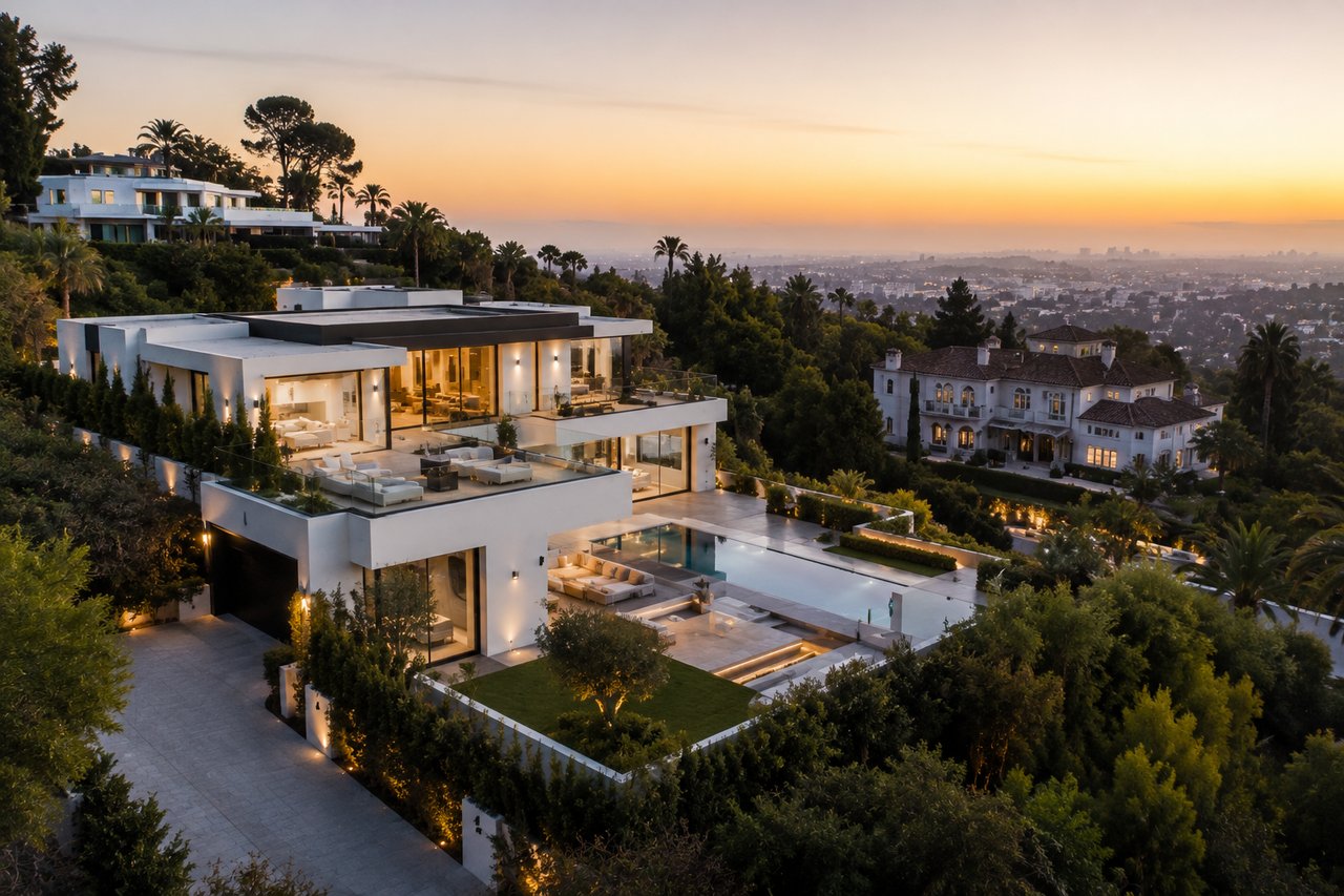
The Riviera and Hillside Enclaves: Terrain-Driven Development Constraints
Hillside properties present opposite constraints from compact coastal lots. Luxury real estate in Los Angeles isn't driven by headlines but shaped by private conversations, timing, and access. The most meaningful transactions often unfold within trusted circles, where discretion carries as much weight as value. For those who understand this world, visibility is secondary to precision, and timing is everything. Christina Pope at Sotheby's International Realty (EliteResidenceInternational.com) works with clients who recognize that Riviera and hillside properties require specialized due diligence around terrain-driven regulations.
Slope percentage determining maximum building heights
The Riviera section north of Sunset Boulevard offers tree-lined streets and larger lots, often featuring Mediterranean or Spanish-style homes. The Baseline Hillside Ordinance governs construction on slopes to reduce landslide risk and visual impact. Post-fire conditions heighten these concerns. Loss of vegetation and altered soil composition increase erosion and slope instability.
Hillside regulations apply to properties on slopes exceeding 15 percent. Detached ADUs on steep lots face constraints from setbacks, height, and lot coverage requirements. Projects with major grading require geotechnical reports and slope stability analysis. Fire exposure creates water-repellent soil layers that raise mudslide risk and require specialized foundation solutions.
Grading restrictions on steep terrain
A contested Pacific Palisades hillside project involved roughly 1,760 cubic yards of fill, 1,700 yards more than permitted. The appeal argued the developer submitted plans to create a flat building pad instead of using caissons and exceeded limits set by parcel map approval. The city geologist reconfirmed borings and recalculated slope stability using conservative assumptions. This reinforced the appropriateness of project conditions.
Hillside regulations limit retaining wall height and require terraced designs rather than single tall walls. Foundations may require caissons or deep piles drilled into bedrock to ensure long-term stability. Steeper lots require grading permits and haul route approvals to manage construction traffic.
Ocean view preservation through height limits
Height restrictions along Sunset Boulevard between Pacific Coast Highway and Chautauqua Boulevard protect residential character. Buildings next to homes face 30-foot limits, while structures more than 50 feet away reach 35 feet. Units built more than 100 feet from homes achieve 45-foot maximums. These restrictions apply to an estimated 50 to 60 parcels along Sunset.
Access challenges: narrow roads and steep driveways
Almost all local streets within Pacific Palisades measure narrower than permitted by city fire code, especially in the Alphabet Streets, Rustic Canyon, and Castellammare areas. A majority of long dead-end streets lack sufficient space for fire engine turnarounds. Many intersections create bottlenecks during evacuations. Homes nestle into hillsides via narrow roads leading to just a handful of streets connecting to Pacific Coast Highway. The Los Angeles Fire Department bulldozed 30 vehicles abandoned on Sunset Boulevard and Palisades Drive to clear pathways during the January 2025 fire.
Marquez Knolls and Sunset Corridor: Inland Zoning with Canyon Access
Inland neighborhoods solve problems that coastal and hillside properties create. Luxury real estate in Los Angeles isn't driven by headlines but shaped by private conversations, timing and access. The most meaningful transactions often unfold quietly within trusted circles where discretion carries as much weight as value. Those who understand this world know that visibility is secondary to precision and timing is everything. Christina Pope at Sotheby's International Realty (EliteResidenceInternational.com) works with clients who recognize that Marquez Knolls and the Sunset corridor deliver larger parcels and canyon recreation without steep terrain penalties.
View protection CC&Rs in established neighborhoods
The Marquez Knolls Property Owners Association enforces view protection covenants in 22 Lachman Tracts through binding CC&Rs that run in perpetuity with the land. These private agreements limit structures to one-story height to preserve view corridors between neighboring lots. The City of Los Angeles does not enforce private CC&Rs and places enforcement responsibility on individual property owners with MKPOA support.
MKPOA retains authority to review and approve any structure that exceeds one story in height, rights assigned from the original developers. The association created a Legal Defense Fund reaching $150,000 to assist homeowners who protect view rights and avoid litigation that can get pricey. California Court of Appeals cases that interpreted the CC&Rs confirmed their validity and enforceability. CC&Rs do not prohibit homes greater than one-story provided construction does not detract from views from other lots.
Larger parcels and outdoor space opportunities
Marquez Knolls and Marquez Highlands feature predominantly single-family homes on parcels that measure 7,000 to 15,000 square feet with flatter, more usable yards conducive to additions or ADUs. These lots provide gentler slopes and conventional driveways. They balance space and access without the steepest grades that characterize bluff properties. Mid-century ranch homes, Traditional and Cape Cod styles, plus newer custom builds populate the area. Deeper lots support play structures, pools, sport courts and gardens.
Trail access and natural buffers
Temescal Gateway Park covers 141 acres of oak and sycamore canyons with access to miles of trails in Topanga State Park, Will Rogers State Historic Park and the 20,000-acre Big Wild. The park offers easy to moderate trails, picnic areas, restrooms, meeting rooms, an auditorium and classrooms for educational programs. Properties that back to canyonlands gain natural buffers from Sunset Boulevard activity while maintaining quick access to the Village and Pacific Coast Highway.
Elite Community Comparisons: Pacific Palisades vs. Malibu vs. Hidden Hills
A comparison of Pacific Palisades neighborhoods with Malibu and Hidden Hills reveals how regulatory frameworks create distinct luxury submarkets. Luxury real estate in Los Angeles isn't driven by headlines but shaped by private conversations, timing and access. The most meaningful transactions often unfold in quiet within trusted circles, where discretion carries as much weight as value. Christina Pope at Sotheby's International Realty (EliteResidenceInternational.com) works with clients who recognize that governance structures matter more than square footage alone.
Malibu's environmental review and ESHA requirements
Malibu's whole 21-mile coastline sits within California's coastal zone and subjects all development to the city's Local Coastal Program certified in 2002. Projects located within Environmentally Sensitive Habitat Areas or within 100 feet of ESHA trigger Environmental Review Board evaluation. The ERB has professionals with expertise in biological resources and geology who review individual and cumulative impacts before Planning Director or Planning Commission decisions. California Environmental Quality Act compliance requires additional documentation unless projects qualify for categorical exemptions, which include single-family residences and guest houses.
Hidden Hills' architectural review board process
Hidden Hills layers homeowners association governance over municipal regulations and creates the most restrictive development environment among these three communities. The Architectural Review Committee requires written approval before any construction activity or improvement begins. Property owners must submit descriptions and plans covering style, design, color, materials and lot location. Applications require drawings that show accessory buildings, fences, drainage structures and all proposed materials with specific colors.
Gated vs. open-access community dynamics
Hidden Hills operates as a fully gated community with single-entry access control and requires authorized vehicles to use Access Control Devices. This controlled access eliminates through traffic and creates a secure environment where residents enjoy equestrian trails without concerns about unauthorized visitors. Pacific Palisades maintains open access through three main entrance points and concentrates traffic but preserves public coastal access.
How terrain and governance create distinct luxury markets
Price points create clear distinctions. Pacific Palisades trades at $3,997,499, Malibu commands $5,647,500, while Hidden Hills operates at $9,350,000 and reflects both exclusivity and substantial acreage. Hidden Hills' approximately 700 homes serve under 2,000 residents across one to three-acre lots with equestrian zoning. Malibu prioritizes beachfront living with coastal permit navigation, whereas Hidden Hills enforces estate-scale exclusivity through layered governance.
Navigating Permits, Hazards, and Property-Specific Constraints
Permit requirements separate prepared buyers from those who find constraints mid-transaction. Luxury real estate in Los Angeles isn't driven by headlines but shaped by private conversations, timing and access. The most meaningful transactions often unfold quietly within trusted circles, where discretion carries as much weight as value. For those who understand this world, visibility is secondary to precision and timing is everything. Christina Pope at Sotheby's International Realty (EliteResidenceInternational.com) works with clients who recognize that Pacific Palisades neighborhoods need specialized permit navigation before escrow closes.
Environmental Health review for oceanfront septic systems
The Department of Public Health Environmental Health Division must review homes using septic systems for remodels. This ensures new construction doesn't encroach upon existing systems and adequate space remains for replacement dispersal systems. Property owners must designate and test a future expansion area, with undeveloped portions categorized as well suited, moderately suited or unsuitable for dispersal system installation. A 10% exemption allows one-time expansion up to 10% of home footprint without designating future expansion areas, as long as the expansion excludes bedroom additions and a geologist confirms suitable areas exist. Qualified septic contractors must evaluate existing systems older than 15 years to determine appropriate sizing and functionality.
Fire safety mandates in Very High Fire Hazard zones
Pacific Palisades sits within Very High Fire Hazard Severity Zones. Hazard scores reflect fire history, fuel loads, predicted flame length, terrain and typical weather patterns. The Wildland-Urban Interface code mandates non-combustible siding, ember-resistant vents, dual-pane tempered windows and Class A rated roofs. Homeowners must clear flammable brush 200 feet from structures in high-risk zones. Eighty percent of Los Angeles County voters support tougher building codes for fire resistance despite added costs.
Retaining wall and drainage requirements for hillside lots
Wildfires destabilize soil and alter drainage patterns, which heightens permit scrutiny for post-fire conditions. Licensed geotechnical engineers must prepare soils and geology reports for most hillside rebuilds. Fire exposure creates water-repellent soil layers that elevate mudslide risk and need specialized foundation solutions. Hillside regulations limit retaining wall height and need terraced designs rather than single tall walls. Foundations may need caissons or deep piles drilled into bedrock for long-term stability.
Working with local expertise for permit navigation
Los Angeles County streamlined permitting for Palisades Fire rebuilds. 'Like-for-like' projects can bypass certain Green Building Code provisions including electric vehicle charger installation, cool roof requirements, graywater irrigation systems and low impact development requirements for pre-2009 buildings. The one-stop support center at 16925 Marquez Avenue provides coordinated assistance from Building and Safety, Bureau of Engineering, Fire Department, City Planning and Water and Power representatives. Rebuild approvals involve multiple agencies working in parallel rather than sequence, with coordination needed to avoid bottlenecks.
Conclusion
To understand Pacific Palisades neighborhoods, you need to read zoning maps and terrain boundaries before viewing properties. R1V1 and R1H1 designations, coastal overlays, slope percentages, and CC&Rs determine development potential more than listing prices reveal. Buyers who analyze ZIMAS data and verify coastal zone status position themselves ahead of those relying on square footage alone. Christina Pope at Sotheby's International Realty (EliteResidenceInternational.com) works with clients who recognize that informed decisions in this market depend on regulatory frameworks. Fire hazard zones and terrain constraints shape luxury outcomes when buyers conduct due diligence.
Key Facts for Buyers
Pacific Palisades luxury real estate depends on zoning maps, terrain boundaries, and regulations that control property value beyond listing prices.
• Zoning designations control building potential: R1V1 permits 55-65% lot coverage on flat terrain, while R1H1 reduces coverage based on slope percentage from 65% to 45% on steepest grades.
• Coastal zone status affects permits: 30% of R1-zoned lots require coastal development permits or qualify for exclusions under CATEX Order E-79-8 through ZIMAS verification.
• Six major canyons create distinct areas: Alphabet Streets offer compact walkable lots while Riviera properties face steep terrain limits.
• Village proximity increases values: Each Walk Score point adds $3,250 to home values, with walkable properties selling for 23.5% more than car-dependent locations.
• Fire hazard zones need special permits: Very High Fire Hazard areas require ember-resistant construction, 200-foot brush clearance, and geotechnical reports for hillside rebuilds.
Smart buyers study regulatory overlays, slope percentages, and canyon boundaries before architects draft plans. ZIMAS data and terrain constraints matter more than square footage comparisons.
FAQs
Q1. What are the main zoning designations in Pacific Palisades and how do they affect property development? Pacific Palisades primarily uses R1V1 and R1H1 zoning designations. R1V1 applies to flatter areas and allows building coverage of 55-63% of lot area depending on lot size. R1H1 governs hillside properties and uses slope-based percentages, permitting 65% coverage on slopes under 15% and progressively less on steeper terrain. These designations directly determine how much you can build and where structures can be placed on your property.
Q2. How does coastal zone status impact development in Pacific Palisades? Approximately 30% of R1 zoned lots in Pacific Palisades fall within the California Coastal Zone, requiring additional review under the Coastal Act. Properties may qualify for Coastal Exemptions or need Coastal Development Permits depending on the project scope. You can verify coastal zone status through the ZIMAS mapping tool, which shows whether your property falls under coastal jurisdiction and any applicable exclusion zones.
Q3. Why do properties near the Pacific Palisades Village command higher prices? Walkability to the Village creates measurable value premiums. Research shows each additional Walk Score point adds approximately $3,250 to home values, and walkable homes sell for about 23.5% more than comparable non-walkable properties. Proximity to shops, cafes, and the farmers' market reduces vehicle dependency and increases showing activity, often generating multiple offers.
Q4. What special considerations apply to hillside properties in Pacific Palisades? Hillside properties face terrain-driven constraints including slope-based building limits, grading restrictions, and specialized foundation requirements. Slopes exceeding 15% trigger the Baseline Hillside Ordinance, which may require geotechnical reports, terraced retaining walls instead of single tall walls, and caissons drilled into bedrock. Height restrictions also protect ocean views for neighboring properties.
Q5. What permits are required for rebuilding or remodeling in Pacific Palisades? Permit requirements vary by location and project scope. Properties in the Coastal Zone need coastal development review, while homes on septic systems require Environmental Health Division approval. All properties in Pacific Palisades fall within Very High Fire Hazard Severity Zones, mandating ember-resistant vents, non-combustible siding, and Class A rated roofs. Hillside projects typically require soils and geology reports from licensed geotechnical engineers.